

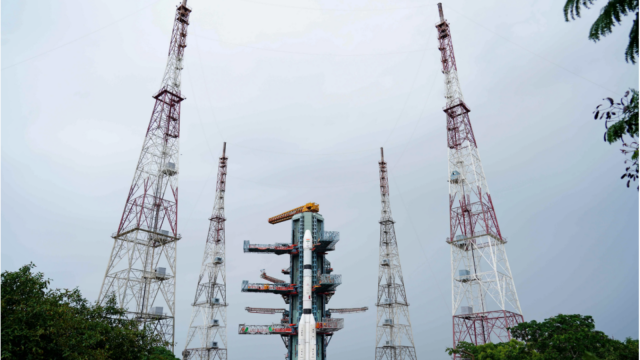
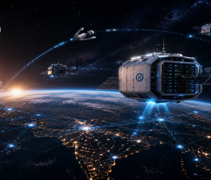
ISRO’s NVS-03 mission is an important step towards strengthening India’s indigenous satellite navigation system, NavIC. The satellite is designed to improve navigation services, introduce an additional signal frequency and support applications ranging from railway tracking to disaster management.
ISRO’s NVS-03 Mission Targets India’s Navigation Capabilities
The Indian Space Research Organisation (ISRO) has prepared its GSLV-F18 rocket to carry the NVS-03 navigation satellite into space as part of its efforts to strengthen India’s homegrown navigation network.
The launch was scheduled for October 30, 2026, at 11:51 pm from the Second Launch Pad at Satish Dhawan Space Centre in Sriharikota, Andhra Pradesh.
NVS-03 is the third satellite in India’s second-generation navigation satellite series. It is designed to provide continuity to the Indian Regional Navigation Satellite System (IRNSS), popularly known as Navigation with Indian Constellation (NavIC).
The satellite weighs approximately 2,250 kg and is intended to be placed into a Geosynchronous Transfer Orbit using the GSLV-F18 launch vehicle.
The mission is particularly important because NavIC has faced operational challenges following the loss of the NVS-02 satellite’s intended orbit and the end of the operational life of some older satellites.
The addition of NVS-03 is expected to strengthen the constellation once the satellite reaches its intended orbit and completes the necessary commissioning process.
What Is NavIC and How Does India’s Navigation System Work?
NavIC is India’s independent regional satellite navigation system developed by ISRO.
Previously known as the Indian Regional Navigation Satellite System, it was designed to provide positioning, navigation and timing services across India and an area extending approximately 1,500 kilometres beyond the country’s boundaries.
Like the American Global Positioning System (GPS), NavIC uses signals transmitted by satellites to help compatible receivers determine their location, movement and time.
However, there is an important difference between the two systems.
GPS is designed to provide global coverage, while NavIC primarily focuses on India and its surrounding region.
The system was developed to reduce India’s dependence on foreign satellite navigation services, particularly for applications involving critical infrastructure, transportation, defence and disaster management.
NavIC provides two main services:
- Standard Positioning Service (SPS): Intended for civilian users and applications.
- Restricted Service (RS): An encrypted service intended for authorised users.
These services can support several activities, including vehicle navigation, maritime operations, surveying, emergency response and accurate time synchronisation.
Why NVS-03 Is Important After NavIC’s Recent Setbacks
The NVS-03 mission comes at a time when India’s navigation constellation needs additional operational satellites.
In a written reply to Parliament in July 2026, the government stated that only three satellites were available for providing positioning, navigation and timing services through NavIC.
These included IRNSS-1B, IRNSS-1I and NVS-01.
The government clarified that at least four operational satellites are required to provide standalone positioning services. Consequently, NavIC could not independently provide its full positioning service with the available constellation, although its timing service remained functional.
One of the major setbacks occurred during the NVS-02 mission, launched on January 29, 2025.
Although the satellite was successfully launched into an initial transfer orbit, it could not reach its intended operational orbit because of a technical problem during the orbit-raising process.
The investigation found that the drive signal was not delivered to a pyro valve in the engine’s oxidiser line.
This prevented the necessary manoeuvre to raise the satellite into its intended orbit.
The NVS-03 mission is therefore important for restoring and strengthening India’s independent navigation capabilities.
However, the launch alone will not immediately guarantee the restoration of all NavIC services. The satellite must first be placed in the correct orbit, tested and made operational.
Indigenous Atomic Clock Is a Major Feature of NVS-03
One of the important technologies onboard NVS-03 is its indigenous atomic clock.
Atomic clocks are essential components of satellite navigation systems because they provide highly accurate time measurements.
Satellite navigation depends on calculating how long signals take to travel from satellites to receivers on Earth.
Even small timing errors can result in significant positioning inaccuracies.
For example, navigation receivers calculate distances by measuring the time difference between transmitted signals and their arrival at the receiver. Accurate satellite clocks are therefore essential for reliable positioning.
NVS-03 will carry an indigenous atomic clock along with procured atomic clocks.
The inclusion of an Indian-developed clock is important for technological self-reliance. It can help strengthen domestic capabilities in precision timing technology, which is also relevant to telecommunications, scientific research and other critical applications.
NVS-01, launched in May 2023, was the first second-generation NavIC satellite to carry an indigenous atomic clock.
NVS-03 continues this technological development while adding other improvements to the navigation system.
New L1 Signal Could Improve NavIC Compatibility
Another important feature of NVS-03 is the addition of the L1 frequency band.
Earlier NavIC satellites primarily used the L5 and S frequency bands for navigation services.
The second-generation NVS satellites are designed to introduce the L1 signal alongside these existing frequencies.
L1 is widely used by satellite navigation systems, including GPS. Its inclusion in NavIC could make it easier for compatible receivers and devices to use signals from multiple navigation constellations.
This is particularly relevant for smartphones, vehicle navigation equipment and other consumer devices.
Many modern devices already support multiple satellite navigation systems. The addition of NavIC’s L1 signal could improve compatibility with suitable multi-constellation receivers.
It may also help encourage manufacturers to integrate NavIC support into more products sold in India.
However, the actual improvement will depend on receiver hardware, software support, signal availability and the operational status of the satellite constellation.
The addition of a new frequency does not automatically mean that every existing smartphone will receive better navigation performance.
How NavIC Could Help Indian Railways and Road Transport
One of the important civilian applications of NavIC is transportation.
Accurate satellite positioning can support vehicle tracking, fleet management and navigation services.
For Indian Railways, satellite-based positioning technology can help monitor train movements and provide location information for operational systems.
Real-time train tracking can help railway authorities improve visibility over train locations and support passenger information services.
The Indian government has also been working towards expanding satellite-based train tracking. According to reporting by The Indian Express, around 8,700 trains had already been equipped with the relevant tracking system, with a wider target of approximately 12,000 trains.
NavIC can also support road transportation.
Compatible vehicle tracking devices can use satellite navigation signals to identify vehicle locations and transmit information to monitoring systems.
This can be useful for public transport authorities, logistics companies, emergency services and commercial fleet operators.
For ordinary commuters, the benefits may eventually appear through better-supported navigation applications and vehicle tracking services.
However, NavIC is not a replacement for every existing navigation technology. Devices may continue using GPS and other satellite systems alongside NavIC.
Role of NavIC in Disaster Management and Maritime Navigation
India’s geographical conditions make reliable navigation and positioning services important for disaster management.
Floods, cyclones, landslides and other emergencies can disrupt communication networks and transportation infrastructure.
Satellite navigation can help emergency teams identify locations, coordinate response activities and track vehicles carrying relief materials.
For example, during flood-related emergencies, compatible positioning systems can support the movement of rescue vehicles and help authorities coordinate operations across affected districts.
NavIC can also contribute to maritime navigation.
India has a long coastline and a large fishing community that depends on safe navigation at sea.
Satellite-based positioning can help fishing vessels determine their locations and support communication and safety-related services when integrated with suitable equipment.
The system’s regional coverage is particularly relevant to India’s surrounding maritime areas.
However, navigation services require compatible receivers and supporting communication infrastructure. Satellite positioning by itself does not replace emergency communication systems or rescue operations.
Why India’s Independent Navigation System Matters
Satellite navigation has become an important part of modern infrastructure.
From smartphone maps and logistics operations to financial networks and power grids, accurate positioning and timing information are used across several sectors.
India’s dependence on foreign navigation systems for certain applications has made the development of NavIC strategically important.
An independent regional navigation system provides India with greater control over the development and availability of its own positioning infrastructure.
It can also support national requirements in areas such as defence, transportation, telecommunications and disaster management.
The system does not mean that India will stop using GPS or other international navigation services.
Instead, NavIC provides an additional option that can operate alongside other satellite constellations.
This multi-constellation approach can improve the availability of navigation signals and give compatible receivers more information for calculating their positions.
For India, strengthening NavIC is therefore both a technological and strategic priority.
What Comes Next for India’s NavIC Satellite Constellation?
NVS-03 is part of a broader second-generation satellite programme that includes five planned satellites: NVS-01, NVS-02, NVS-03, NVS-04 and NVS-05.
NVS-01 was launched successfully in May 2023, while NVS-02 encountered difficulties during orbit raising after its January 2025 launch.
NVS-03 is the next important mission in this sequence. ISRO has also been working on NVS-04 and NVS-05 to strengthen the constellation and improve continuity of navigation services.
The government has indicated that the remaining satellites are at advanced stages of development.
Once the new satellites are deployed and operational, they are expected to strengthen India’s regional navigation infrastructure.
However, maintaining a reliable satellite constellation requires more than launching new spacecraft. Ground stations, signal monitoring, satellite health management and replacement planning are equally important.
For ordinary users, the benefits will depend on how quickly device manufacturers and service providers adopt compatible NavIC technology.
The NVS-03 mission represents an important opportunity for India to strengthen its navigation capabilities, but its long-term success will be measured by the reliability and usefulness of the services it delivers.
Key Takeaways
- ISRO scheduled the GSLV-F18/NVS-03 mission for October 30, 2026, to strengthen India’s indigenous NavIC navigation system.
- NVS-03 carries an indigenous atomic clock alongside procured atomic clocks and introduces the L1 signal alongside existing L5 and S signals.
- NavIC provides regional positioning, navigation and timing services across India and approximately 1,500 kilometres beyond its borders.
- The satellite is expected to support applications involving railways, road transport, maritime navigation, disaster management and critical infrastructure after becoming operational.
Frequently Asked Questions (FAQs)
1. What is ISRO’s NVS-03 mission?
NVS-03 is the third satellite in India’s second-generation NavIC navigation satellite series. It is designed to strengthen the country’s regional satellite navigation system and improve continuity of positioning, navigation and timing services.
2. How is NavIC different from GPS?
GPS is a global satellite navigation system operated by the United States, while NavIC is India’s regional navigation system. NavIC primarily covers the Indian landmass and a region extending approximately 1,500 kilometres beyond its boundaries.
3. What is special about the NVS-03 satellite?
NVS-03 carries an indigenous atomic clock alongside procured atomic clocks. It also introduces the L1 navigation signal in addition to the existing L5 and S signals, potentially improving compatibility with suitable navigation receivers.
4. Will NVS-03 improve navigation on Indian smartphones?
It could improve NavIC compatibility on smartphones and other devices that support the relevant signals. However, the benefits will depend on hardware compatibility, software support and the satellite becoming fully operational.





Leave a comment